31 Aug 2010

First card from Kenya


This is my first card from Kenya, which shows Grey Crowned Crane in Africa. The Grey Crowned Crane (Balearica regulorum) is a bird in the crane family Gruidae. It occurs in dry savannah in Africa south of the Sahara, although it nests in somewhat wetter habitats. This animal does not migrate. There are two subspecies. The East African B. r. gibbericeps (Crested Crane) occurs from eastern Democratic Republic of the Congo through Uganda, of which it is the national bird, and Kenya to eastern South Africa. It has a larger area of bare red facial skin above the white patch than the smaller nominate species, B. r. regulorum (South African Crowned Crane), which breeds from Angola south to South Africa.

This species and the closely related Black Crowned Crane are the only cranes that can roost in trees, because of a long hind toe that can grasp branches. This habit, amongst other things, is a reason why the relatively small Balearica cranes are believed to closely resemble the ancestral members of the Gruidae.
At Copenhagen Zoo. The Grey Crowned Crane has a breeding display involving dancing, bowing, and jumping. It has a booming call which involves inflation of the red gular sac. It also makes a honking sound quite different from the trumpeting of other crane species. The nest is a platform of grass and other plants in tall wetland vegetation. The Grey Crowned Crane lays a clutch of 2-5 eggs. Incubation is performed by both sexes and lasts 28-31 days. Chicks fledge at 56-100 days.

The Grey Crowned Crane is about 1 m (3.3 ft) tall and weighs 3.5 kg (7.7 lbs). Its body plumage is mainly grey. The wings are also predominantly white, but contain feathers with a range of colours. The head has a crown of stiff golden feathers. The sides of the face are white, and there is a bright red inflatable throat pouch. The bill is relatively short and grey, and the legs are black. The sexes are similar, although males tend to be slightly larger. Young birds are greyer than adults, with a feathered buff face. Like all cranes, it feeds on insects, reptiles and small mammals. Although the Grey Crowned Crane remains common over much of its range, it faces threats to its habitat due to drainage, overgrazing, and pesticide pollution.

30 Aug 2010

Cover from Slovakia

Many thanks to Milos for this nice cover from Slovakia.

Marx-Engels-Forum


Marx-Engels-Forum is a public park in the central Mitte district of Berlin, the capital of Germany. It is named for Karl Marx and Friedrich Engels, authors of The Communist Manifesto of 1848 and regarded as the founders of the Communist movement. The park was created by the authorities of the former German Democratic Republic (GDR) in 1986.

The Marx-Engels-Forum lies on the eastern bank of the Spree river. It is bound to the south-west by the river, to the north-west by Karl-Liebknecht-Straße, to the north-east by Spandauer Straße and to the south-east by Rathausstraße obliquely opposite of the Rotes Rathaus. Across the river it faces the site formerly occupied by the Palast der Republik (now demolished) and the Berliner Stadtschloss. Before World War II the area now occupied by Marx-Engels-Forum was a densely populated Old Town quarter between the river and Alexanderplatz, named after a street called Heiligegeiststraße (Holy Ghost Street) which ran across it between Kaiser-Wilhelm-Straße (now Karl-Liebknecht-Straße) and Rathausstraße. The area including the main post office was heavily bombed during Allied air attacks in 1944/45 and most of its buildings reduced to ruins. After the war the ruins were cleared but nothing replaced them.

While the adjacent Nikolaiviertel was to be rebuilt, the GDR authorities in 1977 set up plans for a green space between the Palast der Republik and the Fernsehturm. The sculptor Ludwig Engelhardt was appointed as director of the project to redevelop the site as a tribute to Marx and Engels, the founders of the communist movement to whose ideology the GDR was dedicated. It consists of a rectangular wooded park with a large, circular paved area in the centre with a sculpture by Engelhardt, consisting of larger-than-life bronze figures of Marx (sitting) and Engels (standing). Behind the statues is a relief wall showing scenes from the history of the German socialist movement. The inauguration took place in 1986. After German reunification in 1990, the future of the Marx-Engels Forum became the subject of public controversy. Some Berliners saw the Forum as an unwanted relic of a defunct regime which they opposed, and argued for the removal of the statues and renaming of the park. Others argued that the site had both artistic and historical significance, and should be preserved. The latter view eventually prevailed, assisted by the generally left-wing tone of Berlin politics. The statues are now a tourist attraction, and a steady stream of people sit on Marx's knee to have their photos taken. With regard to the planned extension of the U5 line of the Berlin U-Bahn turning the park into a construction site for several years, the Berlin mayor Klaus Wowereit has recently launched a discussion whether to rebuild the medieval quarter afterwards.

27 Aug 2010

FDC from India: C.R.Raman Pillai

C.V.Raman Pillai was a playwright of Malayalam literature born on 19 May 1858 to middle class parents. His early education included learning Sanskrit and Ayurveda. He grauduated from the University of Madras. C.V.Raman Pillai is considered a pioneer in the field of Malayalam journalism. He worked with many Malayalam and English dailies.

26 Aug 2010

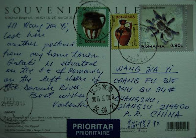
Galaţi, Romania


This is my second card from Galaţi, Romania, and many thanks to Valentin!

Cover from Algeria: Expo in Shanghai 2010

24 Aug 2010

Penghu Islands


The Penghu Islands are an archipelago off the western coast of Taiwan in the Taiwan Strait consisting of 90 small islands and islets covering an area of 141 square kilometers.

'Peng-hu' was first recorded in unofficial historical records and regional logs in 1171 during the Southern Song Dynasty. From the middle of the 17th century to 1895, Taiwan and the archipelago were ruled by pirates, the colonial Dutch Empire ( attempts of conquest from 1622 onward ), the Koxinga kingdom, and the Qing Dynasty, successively.

23 Aug 2010

Two covers from Malaysia


Many thanks to K.K.K. for a aerogramme and a cover from Malaysia!

22 Aug 2010

What they are looking at?


People must be interested in that what these men in the picture looking at. Me too! A really funny and unique card from Portugal!

FDC from France: French Foods

Many thanks to Eric for this great cover from France, but there is another postmark, whose date is different with that of on the special cancellations. However, it looks still quite nice, isn't it?

20 Aug 2010

Kaunas, Lithuania


Kaunas is the second largest city in Lithuania and a former temporary capital. Kaunas is located at the confluence of the two largest Lithuanian rivers, the Nemunas and the Neris, and near the Kaunas Reservoir, the largest body of water entirely in Lithuania. After World War II Kaunas became the main industrial city of Lithuania – it produced about a quarter of Lithuania's industrial output. After the proclamation of Lithuanian independence in 1991, Soviet attempts to suppress the rebellion focused on the Sitkūnai Radio Station.They were defended by the citizenry of Kaunas.

19 Aug 2010

Rakvere, Estonia


Rakvere is a town in northern Estonia and the county seat of Lääne-Viru County, 20 km south of the Gulf of Finland.

Rakvere is also known now for its Tarvas statue of an aurochs, which was made by the Estonian sculptor Tauno Kangro. It is thought to be the largest animal statue in the Baltic countries. It is situated on the edge of Vallimägi hill and was erected for the town's 700th birthday. Along with the granite block it sits on, the statue is seven meters long, four meters high and weighs about seven tons. The statue is made out of bronze. The names of the companies and private people who financed it are engraved in the granite block.

18 Aug 2010

Cover from Croatia

Many thanks to Josef for this nice cover with clear postmarks!

Four seasons in Finland


17 Aug 2010

Card from Poland


Who can help me with the translation of the Polish words on the card?

16 Aug 2010

FDC from Hong Kong: Characteristic Streets

Pottinger Street($1.40)-The street was originally built from Queen's Road Central up to Hollywood Road. Because of its steep slope, the street was praved entirely with stone slabs, forming steps in an undulating pattern to make it easy for people to go up and down and to drain away stormwater.

Nathan Road($1.40)-It runs through the hustling and bustling Yau Tsim Mong Distric, lit up like a kaleidoscope by neon signs of shops, hotels, shopping arcades and restaurants along the way.

Hollywood Road($2.40)-This street is lined with antique shops that lend an air of nostalgic elegance.

Temple Street($2.40)-For a real taste of Hong Kong culture, there is no better place that Temple Street, the street named after Tin Hau temple in Yau Ma Tei. Dubbed "People's Night Market" for its all-time bargains, Temple Street comes alive when the city lights up at dusk.

Des Voeux Road West($3)- Des Voeux Road West is a traditional marketplace for ginseng products and herbs as well as dried seafood.

Stanley Market($3)- Stanley Market Road and Stanley Main Street, Stanley Market is a popular tourist attraction in Southern District on Hong Kong Island.

Many thanks to Hiu Fan for this nice FDC!

15 Aug 2010

Aarau, Switzerland


Aarau is the capital of the northern Swiss canton of Aargau. The city is also the capital of the district of Aarau. It is German-speaking and predominantly Protestant. Aarau is situated on the Swiss plateau, in the valley of the Aar, on the river's right bank, and at the southern foot of the Jura mountains, and is west of Zurich. The municipality borders directly on the Canton of Solothurn to the west. It is the third-largest city in Aargau after Wettingen and Baden. At the beginning of 2010 Rohr became a suburb of Aarau.

The old city of Aarau is situated on a rocky outcropping at a narrowing of the Aar river valley, at the southern foot of the Jura mountains. Newer districts of the city lie to the south and east of the outcropping, as well as higher up the mountain, and in the valley on both sides of the Aar. The neighboring municipalities are Küttigen to the north, Rohr and Buchs to the east, Suhr to the south-east, Unterentfelden to the south, and Eppenberg-Wöschnau and Erlinsbach to the west. Aarau and the nearby neighboring municipalities have grown together and now form an interconnected agglomeration. The only exceptions are Unterentfelden and Eppenberg-Wöschnau to the south, whose settlements are divided from Aarau by the expansive forests of Gönhard and Zelgli. Approximately nine tenths of the city is south of the Aar, and one tenth is to the north. It has an area, as of 2006, of 8.9 km2 (3.4 sq mi). Of this area, 6.3% is used for agricultural purposes, while 34% is forested. Of the rest of the land, 55.2% is settled (buildings or roads) and the remainder (4.5%) is non-productive (rivers or lakes). The lowest elevation, 365 metres (1,198 ft), is found at the banks of the Aar, and the highest elevation, at 471 metres (1,545 ft), is the Hungerberg on the border with Küttigen.

14 Aug 2010

FDC from Singapore: Flora & Fauna Definitives

This year, tp emphasize that Singapore is a bustling metropolis nested in a lush mantle of tropical greenery, another two flowering plants-the Simpoh Air(Dillenia suffruticosa) and Singapore Rhododendron(Melastoma malabathricum) are featured. Both plants can commenly be found in all nature areas in Singapore.

Many thanks to Terence for this nice FDC!

13 Aug 2010

Vlieland Island


Vlieland is a municipality in the northern Netherlands. The municipality of Vlieland has only one major town: Oost-Vlieland (West Frisian: East-Flylân). It is the second-least densely populated municipality in the Netherlands. Vlieland is one of the West Frisian Islands, lying in the Wadden Sea. It is the second island from the west in the chain, lying between Texel and Terschelling. Vlieland was named after the Vlie.

Vlieland can be reached by ferry from the Frisian town of Harlingen. The ferry ride takes about 1.5 hours and crosses the Wadden Sea and part of the North Sea. Tourists are not allowed to bring cars with them on the ferry. Another ferry runs between De Cocksdorp on Texel and the westernmost point of Vlieland. The commonest form of transport on the island is the bicycle; a network of cycle paths criss-crosses the island. A bus service runs from the ferry terminal to the village and campgrounds after the arrival of a ferry, and some time before departure. There is a very small heliport near the village, but it is only used for SAR flights.

11 Aug 2010

Mt. Fuji and Tea Fields


Mt. Fuji is the highest mountain in Japan at 3,776 m (12,388 ft). Along with Mount Tate and Mount Haku, it is one of Japan's "Three Holy Mountains". An active stratovolcano that last erupted in 1707–08, Mount Fuji is just west of Tokyo, and can be seen from there on a clear day. Mount Fuji's exceptionally symmetrical cone is a well-known symbol of Japan and it is frequently depicted in art and photographs, as well as visited by sightseers and climbers.

On this card you may see tea fields at the foot of Mt. Fuji.

10 Aug 2010

Malacca, Malaysia


Malacca City is the capital city of the Malaysian state of Malacca. The Seri Negeri, the State Administrative and Development Centre which houses the Chief Minister's Office, the State Secretary's Office and the Legislative Assembly Hall are located in Malacca City. It has been listed as a UNESCO World Heritage Site together with George Town of Penang on 7 July 2008.

The city of Malacca is located on both sides of the Malacca River near its fall into the Strait of Malacca. The historic central area of the city is located near the old coastline, includes St Paul's Hill with the ruins of the Portuguese fortress, A Famosa and the Dutch Square on the right (eastern) bank of the river, and the old Chinatown on the left (western) bank. The modern city has grown in all directions from this historic core, including to the south (because the present coastline of the Strait of Malacca is somewhat farther down to the south than its original location due to land reclamation). The "Chinese Hill" (Bukit Cina), where a large old Chinese cemetery is located, was formerly located to the northeast of the town, but now is surrounded by the city on all sides.

This church on the card was built by a Frenchman named Paderi Fabre in1849.

9 Aug 2010

Two FDC's from India: Postal Heritage Buildings


Delhi GPO was opened in 1855. The post office was given permanent status in 1865 and it started functioning in the present building in 1885.

Shimla GPO was established in 1883 on the site of a house known and as "Conny Lodge", now is one of the oldest post office buildings in the country.

Udagamandalam HPO was the first post offics at Udagamandalam opened in 1826 with an establishment of a writer and two delivery peons. There are no records as to where the office originally was.

Cooch Behar HPO was initially functioning in the building situated in the Purana Post Office Para. Today it covers 8893 sq. ft.

Nagpur GPO, considered the mother institution in the Postal Circle of the Central Province, is housed in a majestic Victorian building, once the seat of erstwhile Postmaster General of CP & Berar.

Lucknow GPO is an example of relatively more contemporary engineering and architecture. Constructed with red bricks and lime stone, iron was not used in its construction.

8 Aug 2010

Bali, Indonesia


Bali is an Indonesian island located in the westernmost end of the Lesser Sunda Islands, lying between Java to the west and Lombok to the east. It is one of the country's 33 provinces with the provincial capital at Denpasar towards the south of the island. With a population recorded as 3,551,000 in 2009,the island is home to the vast majority of Indonesia's small Hindu minority. About 93.2% of Bali's population adheres to Balinese Hinduism, while most of the remainder follow Islam. It is also the largest tourist destination in the country and is renowned for its highly developed arts, including dance, sculpture, painting, leather, metalworking and music.

Images of Romania


Sometimes somebody sends me a card without sending me an email for swap, and the sender often leaves the address on the card and I send one back in return. These cards are just surprise as those via Postcrossing to me. Now I wonder if the sender of this card has got my card.

7 Aug 2010

Cover from Algeria: World Cup 2010

Again, it is a "FDC" but was not sent on the first issue day. I can still remember the third game for Algeria when it played against USA. Unforgettable!

6 Aug 2010

Ipatiev Monastery, Kostroma


The Ipatiev Monastery, somtimes translated into English as Hypatian Monastery—is a male monastery, situated on the bank of the Kostroma River just opposite the city of Kostroma. It was founded around 1330 by a Tatar convert, Prince Chet, whose male-line descendants include Solomonia Saburova and Boris Godunov.

In 1435, Vasily II concluded a peace with his cousin Vasily Kosoy there. At that time, the cloister was a notable centre of learning. It was here that Nikolay Karamzin discovered a set of three 14th-century chronicles, including the Primary Chronicle, now known as the Hypatian Codex. During the Time of Troubles in Russia, the Ipatiev Monastery was occupied by the supporters of False Dmitriy II in the spring of 1609. In September of that same year, the monastery was captured by the Muscovite army after a long siege. On March 14, 1613, the Zemsky Sobor announced that Mikhail Romanov, who had been in this monastery at that time, would be the Russian tsar.

5 Aug 2010

Palacio de La Moneda, Santiago


My first card from Chile! I wonder if this kind friend has also got my card for her.

Palacio de La Moneda, or simply La Moneda, is the seat of the President of the Republic of Chile. It also houses the offices of three cabinet ministers: Interior, General Secretariat of the Presidency and General Secretariat of the Government. It occupies an entire block in downtown Santiago, in the area known as Civic District.

La Moneda, originally a colonial mint (moneda means coin), was designed by Italian architect Joaquín Toesca. Construction began in 1784 and was opened in 1805, while still under construction. The production of coins in Chile took place at La Moneda from 1814 to 1929. In June, 1845 during president Manuel Bulnes's administration, the palace became the seat of government and presidential residence. In 1930, a public square —named Plaza de la Constitución ("Constitution Square")— was built in front of the palace. After the presidency of Gabriel González Videla it ceased to serve as a presidential residence.

During the military coup d'état, on September 11, 1973, the palace was partially destroyed by aerial bombing by the Chilean Air Force. President Salvador Allende allegedly killed himself in the palace as it was under assault by the armed forces. Reconstruction and restoration projects were completed on March 11, 1981, although some bullet marks have been preserved and can still be seen nowadays. An underground office complex (the so called "bunker") was built under the front square, during the 1973-1980 restorations to provide a safe escape for then General Augusto Pinochet and for succeeding Chilean presidents in case of an attack. During President Ricardo Lagos's administration, the palace's inner courtyards were opened to the public during certain hours of the day. Lagos also re-opened Morandé 80 — a gate used by Chilean presidents to enter the palace since the early 20th century. It was eliminated during the restoration of the palace as not being in the original plans, but was restored because of the heavy symbolism attached to it as being the gate through which Chilean Presidents entered La Moneda skipping the main's gate guard protocol or, in other words, as ordinary citizens of the Republic. It was also the gate through which the body of President Allende was taken out after the 1973 coup.

4 Aug 2010

Original cover of China: Gulangyu

I went to Xiamen by the end of June for a short travel. And there I made this registered cover for myself, on which I affixed a set of three stamps showing this small island issued in 2003. Gulangyu is a car free island off the coast of Xiamen, Fujian province in southern China, about 2km2 in area. It is home to about 20,000 people and is a very popular tourist destination. Visitors can reach it by ferry from Xiamen Island in about 5 minutes. Gulangyu Island is renowned for its beaches and winding lanes and its varied architecture. The island is on China's list of National Scenic Spots and also ranks at the top of the list of the ten most-scenic areas in Fujian Province.

North Norfolk Steam Railway


The North Norfolk Steam Railway, running between the coastal town of Sheringham and Holt, which is further inland. The railway cuts through the countryside to the east of Weybourne with views of its windmill and passes through the well preserved country station which also houses a locomotive shed together with a carriage maintenance and restoration centre. The Norfolk Orbital Railway, an independent organisation, has plans to join and link the NNR with the Mid-Norfolk Railway. The line, which is just over 5 miles (8.0 km) long, once formed part of the Midland and Great Northern Joint Railway. At Sheringham the line has now been reconnected to the National Rail network via an 'occasional use' level crossing. There are two stops between Sheringham and Holt, Weybourne (actually about 1 mile (1.6 km) from the village and the former Army camp) and Kelling Heath.

The NNR operates both steam- and diesel-hauled services, and organizes a programme of seasonal special events. A museum has been built at Holt to display some of the lines many artifacts from the Midland and Great Northern Railway. The station building at Holt was originally built at Stalham in 1883 and in 2002 was moved, brick by brick, to be re-erected in its current location at Holt. This project was awarded second place in the 2006 railway buildings competition by the Heritage Railways Association of the UK. The signal box, which can also been seen at the station, is over 100 years old and was restored on site. The full signalling system at Holt, with 14 signals as well as the box, was commissioned in 2009 - winning the HRA signalling award for that year. The box was formerly located at Upper Portland Sidings in the East Midlands. The Railway won the 'Independent Railway of the Year' award in 2006.

Work on rebuilding the line started in 1965, and on 4 June 1967, two steam locomotives were delivered. The operating company, North Norfolk Railway plc, was launched in 1965 following the granting of two Light Railway Orders. In May 1973, the railway was the scene of filming of the episode The Royal Train of the popular TV programme Dad's Army. Another scheme, the Norfolk Orbital Railway plans to link the town to the market town at Fakenham. At Weybourne, the main restoration sheds are located. They incorporate room to accommodate four standard length British Railways Mark 1 coaches and six large steam or diesel locomotives. New carriage storage sheds have been built near Holt with Heritage Lottery Funding. These have the capacity to store the equivalent of 18 Mark 1 coaches.