

The United States Capitol is the meeting place of the United States Congress, the legislature of the Federal government of the United States. Located in Washington, D.C., it sits atop Capitol Hill at the eastern end of the National Mall. Though not in the geographic center of the District of Columbia, the Capitol is the origin by which the quadrants of the District are divided. Officially, both the east and west sides of the Capitol are referred to as "fronts." Historically, however, only the east front of the building was intended for the arrival of visitors and dignitaries.
Prior to establishing the nation's capital in Washington, D.C., the United States Congress and its predecessors had met in Philadelphia, New York City, and a number of other locations. In September 1774, the First Continental Congress brought together delegates from the colonies in Philadelphia, followed by the Second Continental Congress, which met from May 1775 to March 1781. After adopting the Articles of Confederation, the Congress of the Confederation was formed and convened in Philadelphia from March 1781 until June 1783, when a mob of angry soldiers converged upon Independence Hall, demanding payment for their service during the American Revolutionary War. Congress requested that John Dickinson, the governor of Pennsylvania, call up the militia to defend Congress from attacks by the protesters. In what became known as the Pennsylvania Mutiny of 1783, Dickinson sympathized with the protesters and refused to remove them from Philadelphia. As a result, Congress was forced to flee to Princeton, New Jersey, on June 21, 1783, and met in Annapolis, Maryland and Trenton, New Jersey before ending up in New York, New York.
The United States Congress was established upon ratification of the United States Constitution and formally began on March 4, 1789. New York City remained home to Congress until July 1790, when the Residence Act was passed to pave the way for a permanent capital. The decision to locate the capital was contentious, but Alexander Hamilton helped broker a compromise in which the federal government would take on war debt incurred during the American Revolutionary War, in exchange for support from northern states for locating the capital along the Potomac River. As part of the legislation, Philadelphia was chosen as a temporary capital for ten years (until December 1800), until the nation's capital in Washington, D.C. would be ready. Pierre (Peter) Charles L'Enfant was given the task of creating the city plan for the new capital city. L'Enfant chose Jenkins Hill as the site for the Capitol building, with a grand boulevard connecting it with the President's House, and a public space stretching westward to the Potomac River. In reviewing L'Enfant's plan, Thomas Jefferson insisted the legislative building be called the "Capitol" rather than "Congress House". The word "Capitol" comes from Latin, meaning city on a hill and is associated with the Roman temple to Jupiter Optimus Maximus on Capitoline Hill. In addition to coming up with a city plan, L'Enfant had been tasked with designing the Capitol and President's House, however he was dismissed in February 1792 over disagreements with President George Washington and the commissioners, and there were no plans at that point for the Capitol.


 Quan ho Bac Ninh are folk songs in Northern Vietnam. The songs are performed as alternating verses between two women from one village who sing in harmony, and two men from another vollage who respond with similar melodies. It also is a form of instant exchange pf a love between men and women. Quan ho Bac Ninh is recognized as the cultural heritage intangible representation of humanity by UNESCO on 30th of September 2009.

 My first card from Ireland!
 Many thanks to David for this nice cover from Mauritius! He used a Chinese envolope!

 The Ming Xiaoling Mausoleum is the tomb of the Hongwu Emperor, the founder of the Ming Dynasty. It lies at the southern foot of Purple Mountain, located east of the historical center of Nanjing, China. Legend says that in order to prevent robbery of the tomb, 13 identical processions of funeral troops started from 13 city gates to obscure the real burying site. The construction of the mausoleum began during the Hongwu Emperor's life in 1381 and ended in 1405, during the reign of his son the Yongle Emperor, with a huge expenditure of resources involving 100,000 laborers. The original wall of the mausoleum was more than 22.5 kilometers long. The mausoleum was built under heavy guard of 5,000 military troops.
 Sylt is an island in northern Germany, part of Nordfriesland district, Schleswig-Holstein and well known for the distinctive shape of its shoreline. It belongs to the North Frisian Islands and is the largest island in North Frisia. The northernmost island of Germany, it is known for its tourist resorts, notably Westerland, Kampen and Wenningstedt-Braderup, as well as for its 40 km long sandy beach. It is frequently covered by the media in connection with its exposed situation in the North Sea and its ongoing loss of land during storm tides. Since 1927, Sylt has been connected to the mainland by the Hindenburgdamm causeway.

 Les Sables-d'Olonne (French meaning: "the sands of Olonne") is a seaside town in western France, by the Atlantic Ocean. It is a commune and a sub-prefecture of the Vendée department.
 Manitoba is a Canadian prairie province with an area of 649,950 square kilometres (250,900 sq mi). The province has over 110,000 lakes and has a largely continental climate because of its flat topography. Agriculture, mostly concentrated in the fertile southern and western parts of the province, is vital to the province's economy; other major industries are transportation, manufacturing, mining, forestry, energy, and tourism. The largest ethnic group in Manitoba is English Canadian, but there is a significant Franco-Manitoban minority and a growing aboriginal population.
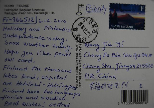 Tengmalm's Owl, Aegolius funereus, is a small owl. It is known as the Boreal Owl in North America. This species is a part of the larger grouping of owls known as typical owls, Strigidae, which contains most species of owl. The other grouping is the barn owls, Tytonidae. This bird is named after the Swedish naturalist Peter Gustaf Tengmalm.
 Discovery Bay (DB) is a mixed, primarily residential, development comprising a residential development and private and public recreational facilities in Hong Kong. It is situated on the north-eastern coast of Lantau Island in the New Territories. The development spans an area of 650 hectares, and includes two bays, the Tai Pak Bay (大白灣) and Yi Pak Bay (二白灣).
 The United States Capitol is the meeting place of the United States Congress, the legislature of the Federal government of the United States. Located in Washington, D.C., it sits atop Capitol Hill at the eastern end of the National Mall. Though not in the geographic center of the District of Columbia, the Capitol is the origin by which the quadrants of the District are divided. Officially, both the east and west sides of the Capitol are referred to as "fronts." Historically, however, only the east front of the building was intended for the arrival of visitors and dignitaries.
 Melbourne is the capital and most populous city in the state of Victoria, and the second most populous city in Australia. The Melbourne City Centre (also known as the "Central Business District" or "CBD") is the hub of the greater geographical area (or "metropolitan area") and the Census statistical division—of which "Melbourne" is the common name. As of June 2009, the greater geographical area had an approximate population of four million. Inhabitants of Melbourne are called Melburnians. The metropolis is located on the large natural bay known as Port Phillip, with the city centre positioned at the estuary of the Yarra River (at the northern-most point of the bay). The metropolitan area then extends south from the city centre, along the eastern and western shorelines of Port Phillip, and expands into the hinterland. The city centre is situated in the municipality known as the City of Melbourne, and the metropolitan area consists of a further 30 municipalities.
 German reunification (German: Deutsche Wiedervereinigung) was the process in 1990 in which the German Democratic Republic (GDR/East Germany) joined the Federal Republic of Germany (FRG/West Germany), and when Berlin reunited into a single city, as provided by its then Grundgesetz constitution Article 23. The start of this process is commonly referred by Germans as die Wende (The Turning Point.). The end of the unification process is officially referred to as German unity (German: Deutsche Einheit), celebrated on 3 October (German Unity Day).
 The Plaza Mayor was built during the Habsburg period and is a central plaza in the city of Madrid, Spain. It is located only a few blocks away from another famous plaza, the Puerta del Sol. The Plaza Mayor is rectangular in shape, measuring 129 by 94 meters, and is surrounded by three-story residential buildings having 237 balconies facing the Plaza. It has a total of nine entranceways. The Casa de la Panadería, serving municipal and cultural functions, dominates the Plaza Mayor.


.jpg)


